This was one of the key questions the Victorian Government wanted answered when they engaged Safe System Solutions Pty Ltd to undertake a detailed investigation across the south west of Victoria.
Our role went well beyond assessing the signs themselves. We were asked to understand how people use them, trust them, respond to them, and whether they genuinely influence safer route choice and travel behaviour.
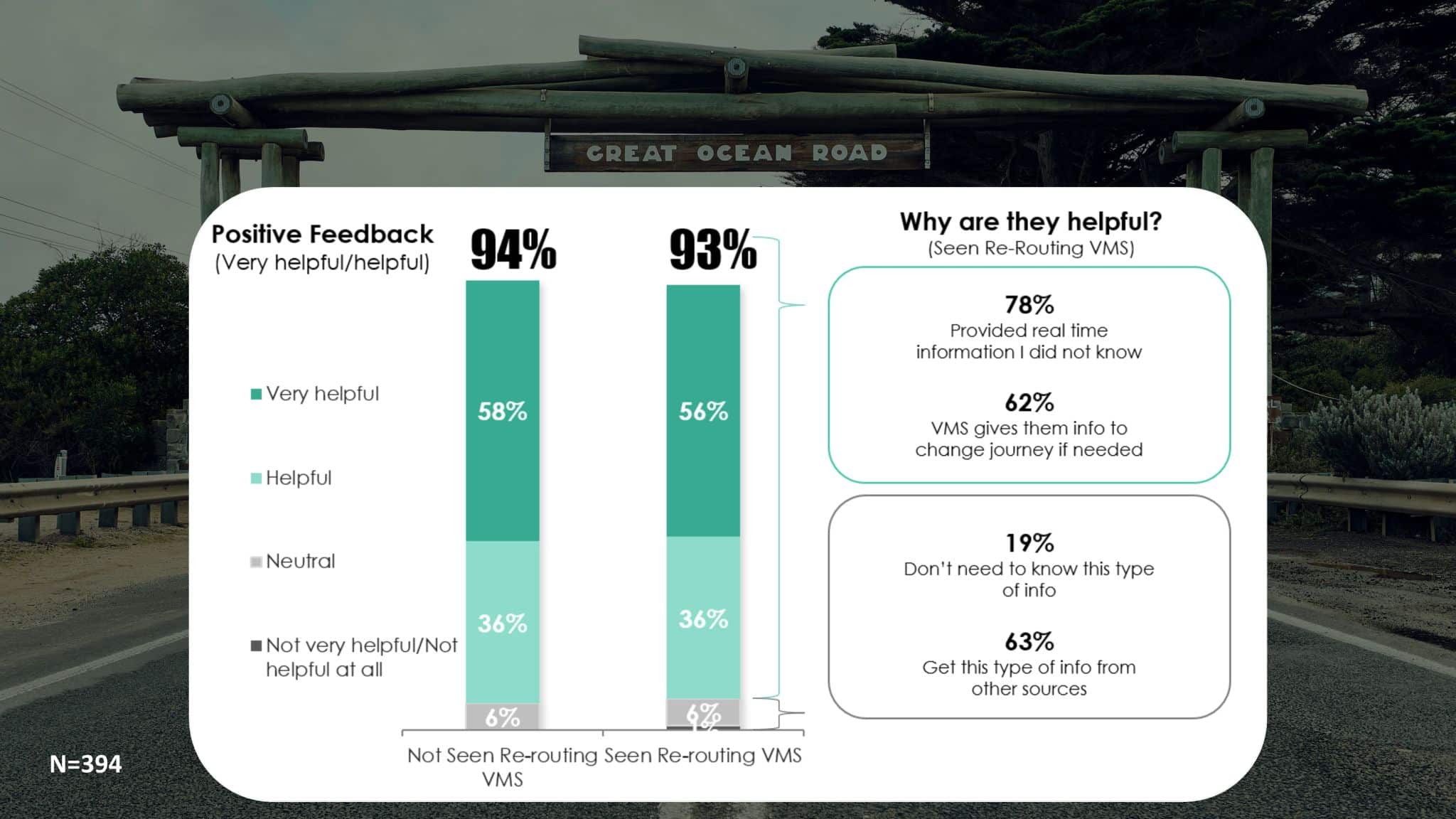
The project involved driving the routes and developing a detailed survey and engagement plan. We ran focus groups with government departments, surveyed 394 drivers who had recently travelled through the area, and completed on ground one on one surveys and discussions with local communities. A big thank you to our friends at Luma Research for their expertise in helping us reach those road users.
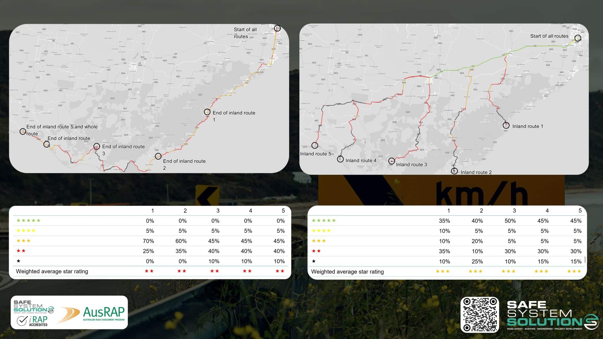
In parallel, our engineering team examined the whole of life costs of the signs, their road safety implications for route choice, and the suitability of both existing and potential future sign locations. Using AusRAP/iRAP data, we assessed the differences in risk between alternative routes to understand the safety context of the information being provided to drivers.
These signs do much more than display travel times. They are also used for road safety messaging, roadway status updates, emergency and weather warnings, and event information. How they are used and where they are located matters, and when deployed strategically, they can influence safer choices by road users.
Another example of combining community insight, engineering analysis, and Safe System thinking to support better road safety decisions on our streets and roads.